Dear list,
My group has been developing some tools that depend on the occurrence density data that GBIF provides through its API:
We have been using the R function rgbif::map_fetch to query the api. The data is returned faithfully but we are experiencing some issues with projections of the raster data.
I have posted a reproducible example in R here:
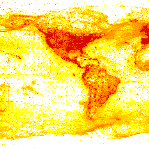
https://github.com/ropensci/rgbif/issues/366 . But briefly the issue is that EPSG:3857 that is downloaded from the API has an extent from -180 to 180 in the x-axis and -86 to 86 in the y-axis but when converting longitude latitude coordinates into the EPSG:3857 coordinate reference system the spatial domain is much larger (I think because it is defined in meters rather than degrees). What am I missing here? I am still a neophyte when it comes to projections so I apologize if this an obvious question.
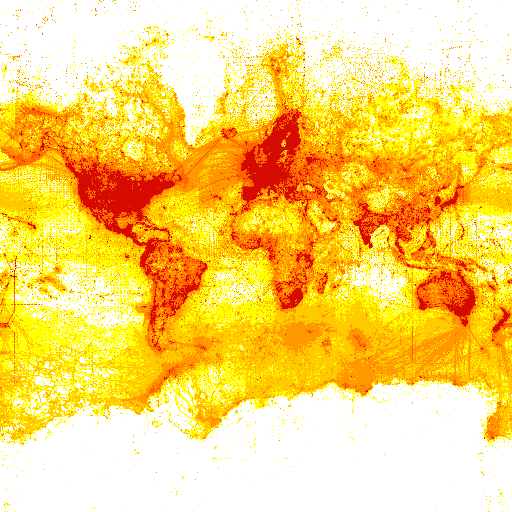
One other quick point is that the GBIF maps API does not seem to serve up the same spatial domain for each projection that is possible. Specifically compare the following two queries to the api:
Note that EGSG:4326 is on a smaller spatial domain that does not include the whole Earth. Maybe this is by design but this webpage led me to believe differently:
https://tile.gbif.org/ui/ '
Thanks in advance for your help!
Dan
--
Daniel J. McGlinn, PhD
Assistant Professor
mailing address:
Department of Biology
College of Charleston
66 George Street
Charleston, SC 29424
https://www.mcglinnlab.orgphysical address:
Rita Hollings Science Center (office: 239, lab: 292)
58 Coming Street, Suite 245-255
Charleston, SC 29401
office: 843-953-0190